Community account
Traditions attributed to family and community sources, clearly identified as such.
Our Roots • Our Heritage • Our Legacy
Six Mounds. One Living Heritage.
Mẹ́ta Nílé, Mẹ́ta Lókò
A home for the history, family traditions and cultural landmarks associated with Òkìtì Mẹ́fà, Ika Orile and the Alákétu family.
This project brings community memory into a record future generations can examine, question and enrich. The supplied project brief places the heritage area in Ika Orile, Yewa North, Ogun State, Nigeria; that identification will be reviewed alongside the approved manuscript.
Traditions attributed to family and community sources, clearly identified as such.
Dated records and verifiable references will be added when the original materials have been reviewed.
Sacred locations and private family information require a separate decision about public access.
Òkìtì Mẹ́fà is presented in the supplied account as the Six Mounds. The traditional expression Mẹ́ta Nílé, Mẹ́ta Lókò is preserved here in its supplied form. The physical arrangement and the interpretation of each mound await review with local custodians.
The Six Mounds and their traditional arrangement. Each mound awaits an individually verified location.
A heritage landmark named in the supplied community account. Its site description and historical associations await custodial review.
The historic pit identified in the supplied account. Its location, condition and interpretation require field documentation.
The remains or traditionally remembered line of the settlement fence. The extent has not been mapped.
A settlement described in the supplied account as Odan Agbon, later known as Abule Adurodewon. The naming history awaits review.
A site associated with the community oral tradition. Further explanation from a knowledgeable custodian is needed.
A named heritage location whose historical associations and coordinates remain to be documented.
The community narrative links Òkìtì Mẹ́fà with Odùduwà, Ọ̀kànbí, Alákétu, Ṣabẹ̀, Alara, Ajero, Òràngún and Ereduwa.
These names are retained from the supplied brief. They are not displayed as a verified family tree, a settled sequence of descent or a universally accepted chronology.
The brief refers to a first Ifá instruction and a period of settlement. The full wording, narrator and context have not yet been supplied.
A second instruction is associated with a two-finger sign. Its meaning will be presented only after the approved account is available.
The brief connects subsequent dispersal with Ika-Méjì. No migration route, dates or geographical coordinates are asserted here.
This is a specific community oral-history tradition. Differing accounts and interpretations will be acknowledged when the manuscript and supporting sources are reviewed.
Six Baales are listed in the supplied family and community historical record.
Provisional transcription: names, affiliations, dates and present leadership status require review against the approved heritage manuscript before publication.
Names and roles will be added after confirmation and approval.
Explore the regional maps below, read the migration-tradition diagram, and follow the field register as heritage locations are verified.
Choose a scale, then use the map controls to explore. These are present-day reference maps; they do not prove historical boundaries or migration routes.
National context: Nigeria in West Africa. Zoom and pan to explore the surrounding region.
Map data © OpenStreetMap contributors · ODbL. Open larger map ↗
No exact marker has been placed for the Six Mounds, shrine or other sacred sites. Similar place names on a reference map should not be treated as a confirmed identification of Ika Orile.
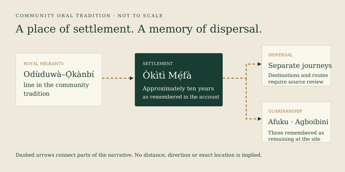
The account remembers a period of approximately ten years at Òkìtì Mẹ́fà before another Ifá instruction directed the migrants to separate. It also remembers Afuku as guardian and Agboibini as entrusted with religious and memorial responsibilities. These are attributed community traditions, not independently established dates or events.
A regional reference map is available now. The precise landmark map will follow field collection and custodial approval. The register below shows each outstanding location without assigning invented coordinates.
Download the geographic register template (CSV) ↓ · Read the field collection guide →
| Heritage location | GPS status | Public display |
|---|---|---|
| Òkìtì Mẹ́fà | Not collected / not verified | Approval pending |
| Odùduwà Memorial Shrine | Not collected / not verified | Approval pending |
| Koto Ofin | Not collected / not verified | Approval pending |
| ODI ILU | Not collected / not verified | Approval pending |
| Odan Agbon / Abule Adurodewon | Not collected / not verified | Approval pending |
| MOKOYA | Not collected / not verified | Approval pending |
| Ile Ijoun | Not collected / not verified | Approval pending |
No illustrative coordinates have been entered. Precise coordinates for sacred or sensitive places belong in a private record unless custodians explicitly approve publication.
This public introduction recognizes the importance of lineage, custodianship and preserving family memory. Detailed ancestral connections await the approved manuscript.
Planned for a later phase with real authentication and access controls. No private records, living-descendant details, burial locations or restricted photographs are included in this website.
Photographs recovered from the September 2026 Public Heritage & Connected Genealogy Edition, shared at the project owner’s request. Captions follow that family archive and do not claim independent identification.
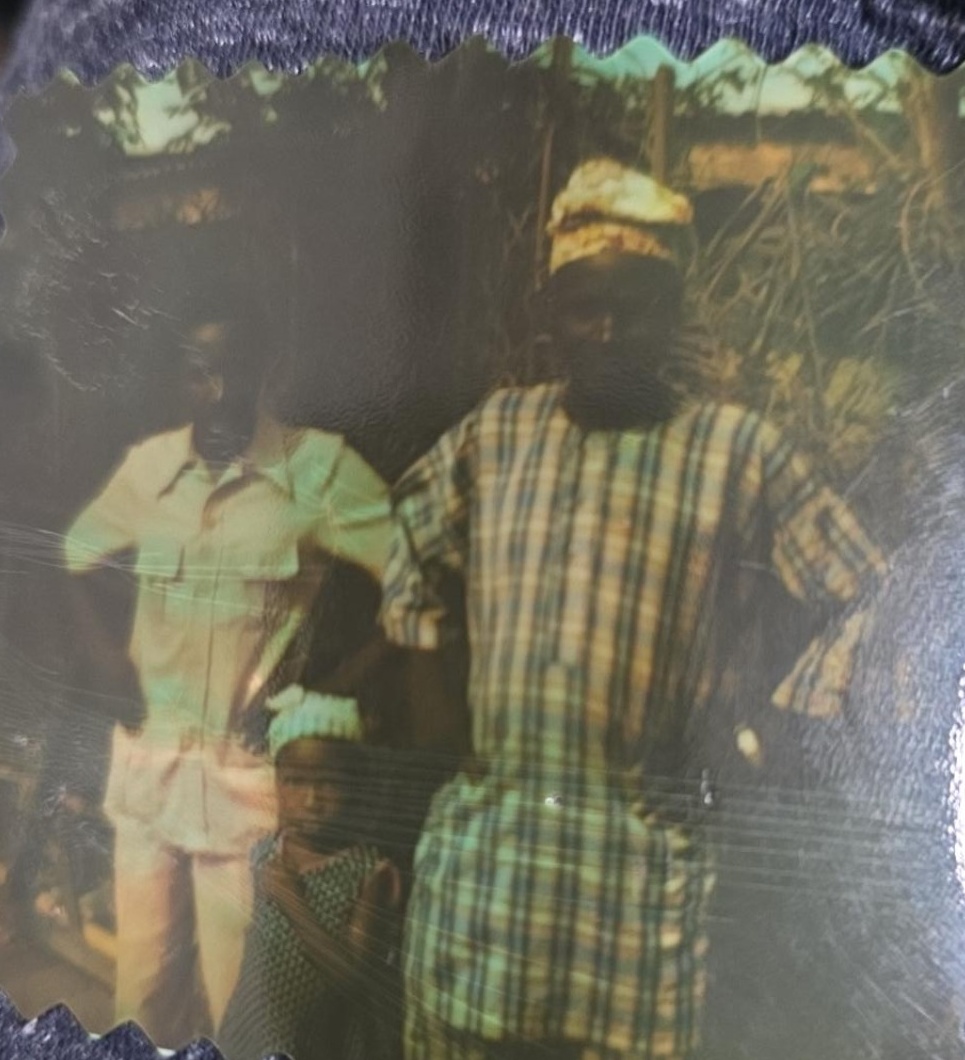
The public heritage edition identifies Abraham Akanbi at right in checkered attire, and his brother Peter Ademola at left in light-colored attire. The photograph is believed to date from the early 1970s; the date is approximate.
Family identification preserved from the 2026 Public Heritage & Connected Genealogy Edition. No identification is assigned here to the child in the photograph.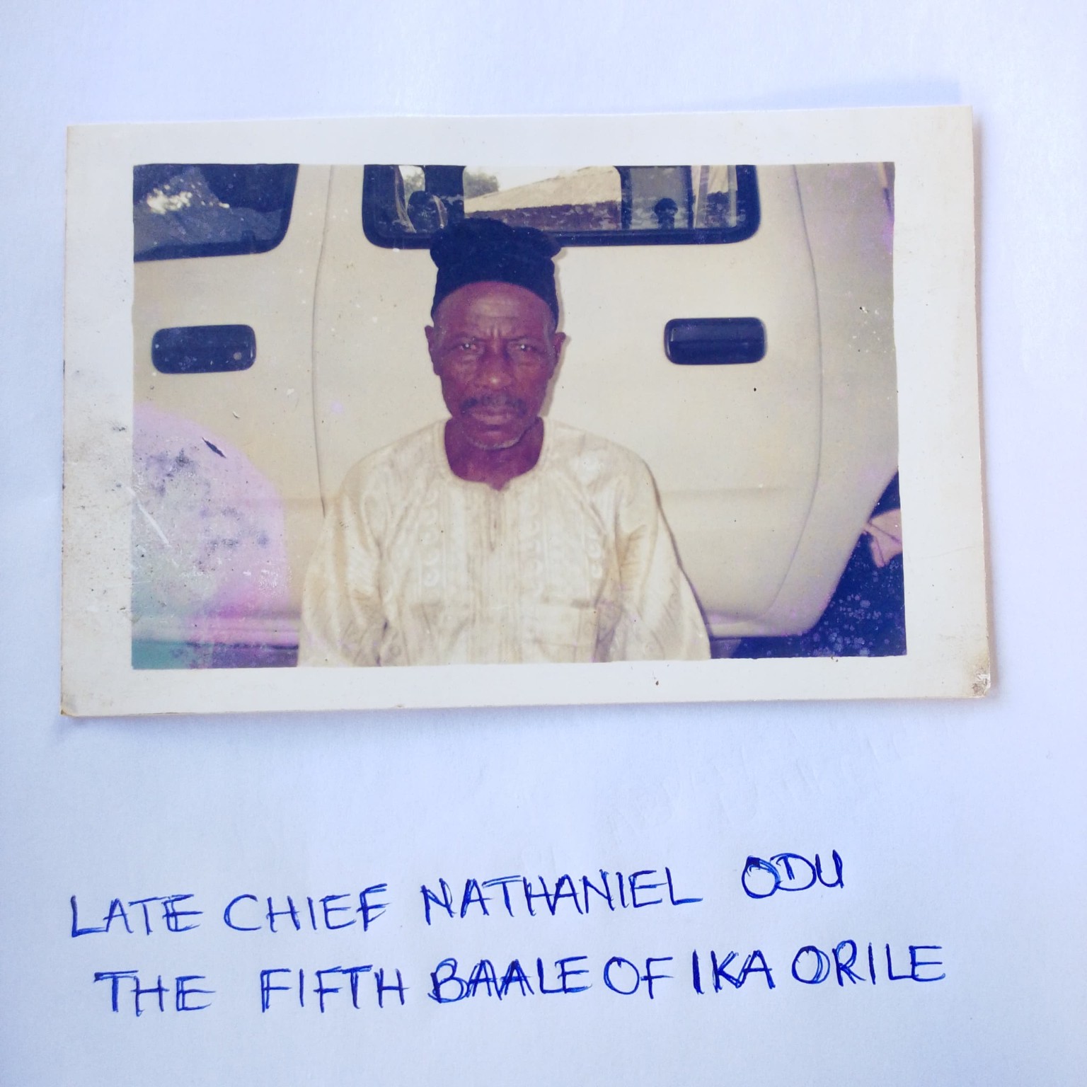
Identified in the public heritage edition as the fifth Baale of Ika Orile. The source records installation in 1976 and death in February 2023.
Source: Public Heritage & Connected Genealogy Edition, 2026. Select the photograph to view the full original.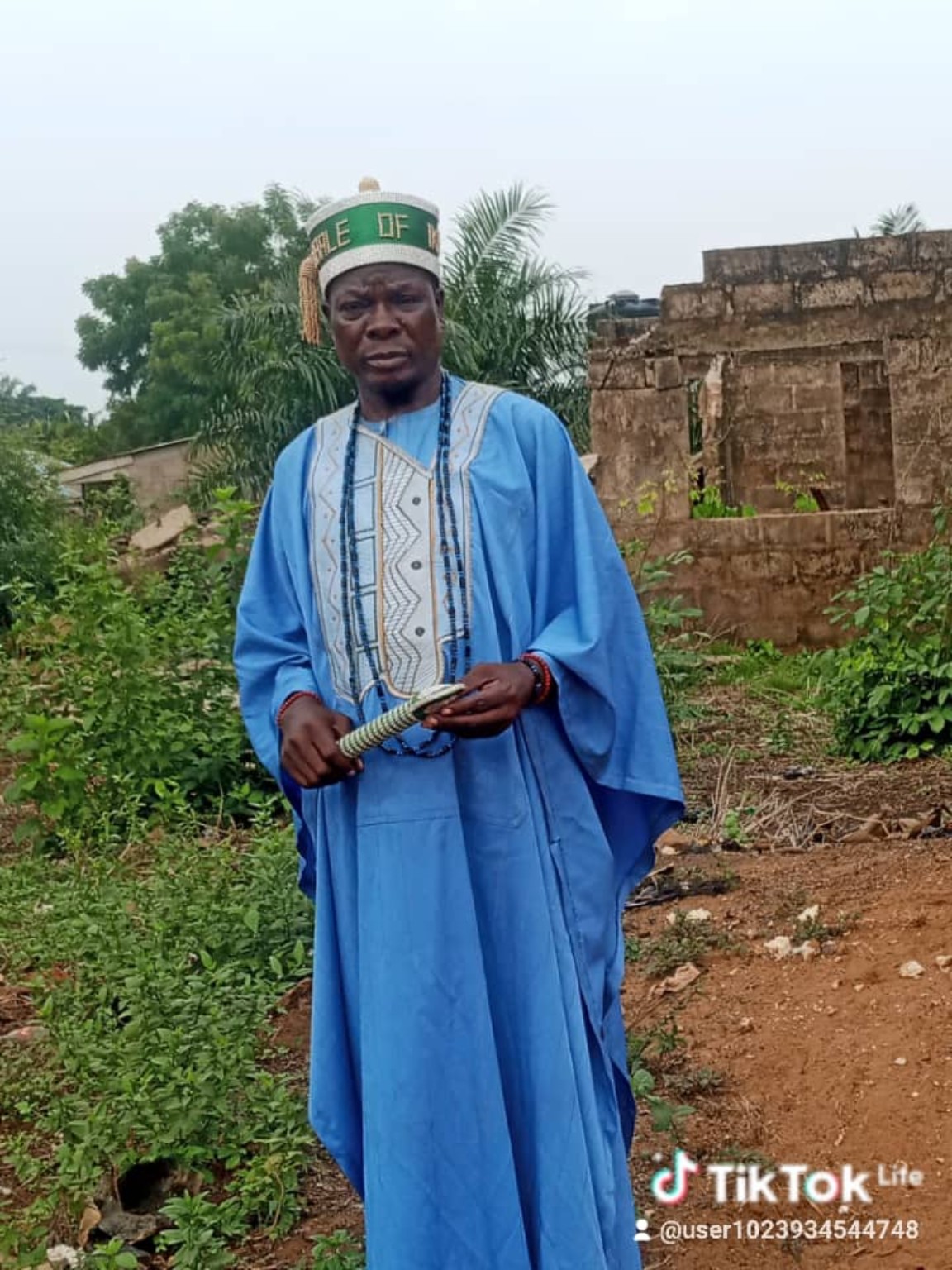
Identified in the public heritage edition as the sixth Baale of Ika Orile, installed June 20, 2023.
Source: Public Heritage & Connected Genealogy Edition, 2026. Select the photograph to view the full original.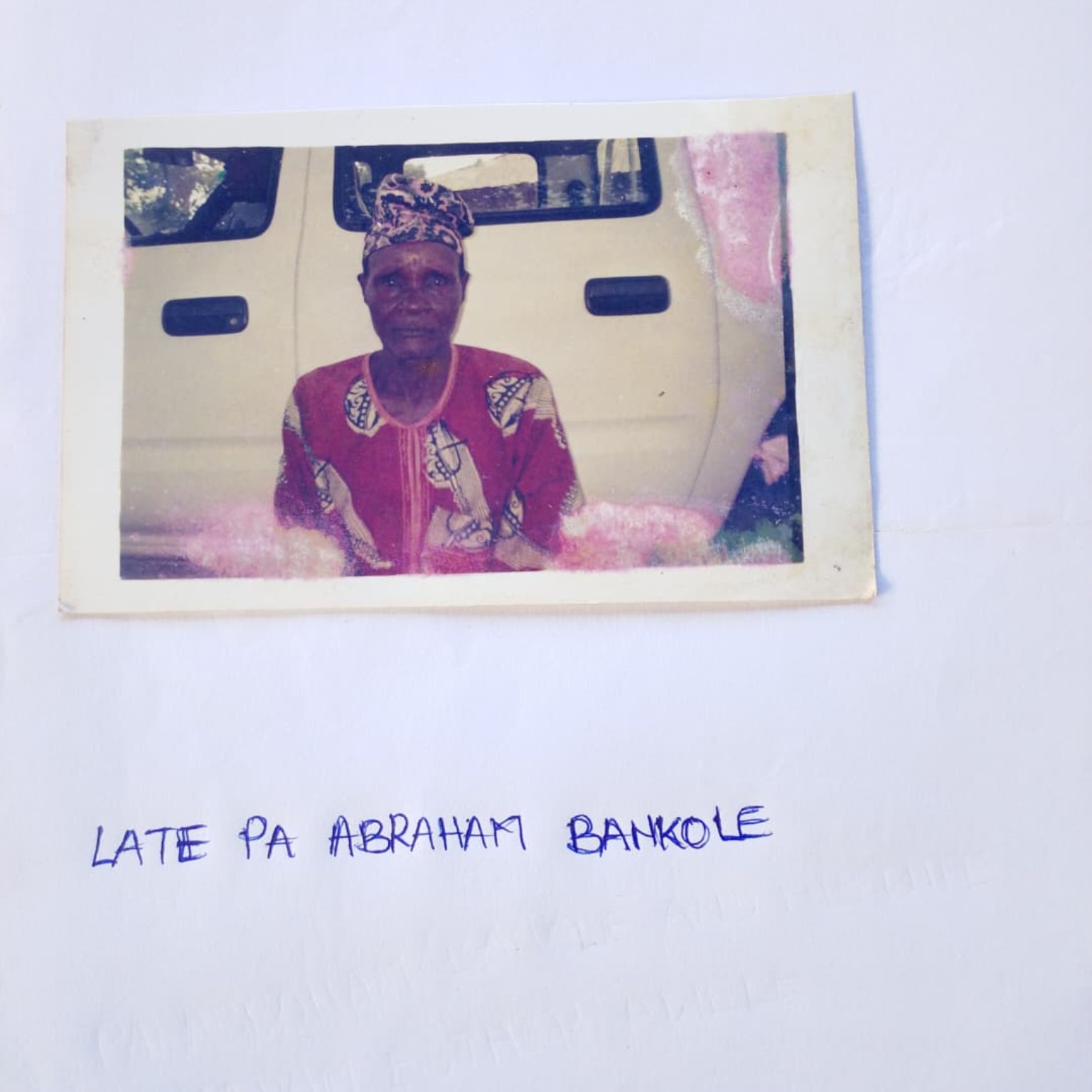
The public heritage edition identifies this portrait with Abraham Akanbi. The original handwritten inscription, “LATE PA ABRAHAM BANKOLE,” is preserved in the image.
Source: Public Heritage & Connected Genealogy Edition, 2026. Select the photograph to view the full original.Site photographs and their approved descriptions will be added as they are identified. The Six Mounds graphic on this page is symbolic and is not a photograph or a map.
Additional community images can be added with names, context and permission. Private family documents and living-descendant records remain outside this website.
Record oral histories with the speaker’s consent. Preserve the narrator’s name, the interview date, language and any access restrictions.
Scan photographs and papers without replacing the originals. Record who holds each item and what is known about its date and context.
Ask custodians to check names and interpretations. Keep uncertain details visible as questions until evidence is available.
Historical narrative follows the project brief supplied by the website owner on November 5, 2026, with the migration summary cross-checked against the community account in the 2026 Public Heritage & Connected Genealogy Edition. Gallery photographs and their identifications were recovered from the earlier Òkìtì Mẹ́fà Public Heritage & Connected Genealogy Edition (2026), at the owner’s request. The full manuscript has not yet been reconciled with every narrative section.
Regional maps use present-day OpenStreetMap data, attributed to its contributors under the Open Database License. Map labels are reference information and are not independent verification of the heritage narrative. The migration diagram follows the concluding community account in the 2026 Public Heritage & Connected Genealogy Edition; it is an interpretation of narrative sequence, not a historical route map.
Future entries should identify the author or narrator, title, date, custodian, relevant page or recording timestamp, permission and verification status. Community contributors and custodians will be acknowledged with their consent.
Have an approved photograph, a remembered place name or a historical document? A contribution contact will be provided after the project owner approves a public channel.
Contact details pending. There is no submission form or upload service in this website.
This website has no account system or contribution database and does not collect submissions. The embedded regional maps load from OpenStreetMap, whose servers receive ordinary web-request information when a map loads. Hosting and map providers process requests under their own privacy policies.
Living-descendant information and private family records are excluded. Historical accounts may contain oral traditions, differing interpretations and matters under continuing research. The content remains provisional pending editorial and custodial review.